Portfolio

Home Forest Garden
This is a hand drawn plan view of a forest garden design. When first visiting a site and talking to our clients about their goals, many conceptual drawings are done as an initial design step. After a layout is decided upon, a digital design is created with species lists, planting arrangement and spaces, and other important details. Initial drawings help us to work with clients and make changes according to their input.

Invasive Species Mapping
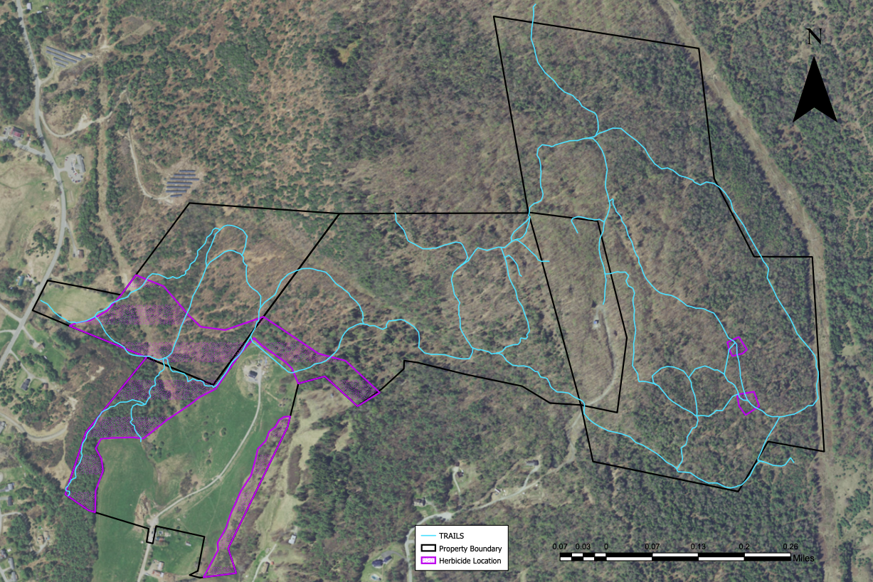
The first step in managing invasive species on a property is accurately mapping the location and extent of the population. Using a combination of on field-based assessment and digital GIS mapping, we can get an accurate picture of the extent and location of the management area. This estimate can then be used to evaluate cost of treatment and restoration planning.

Ecological Site Analysis
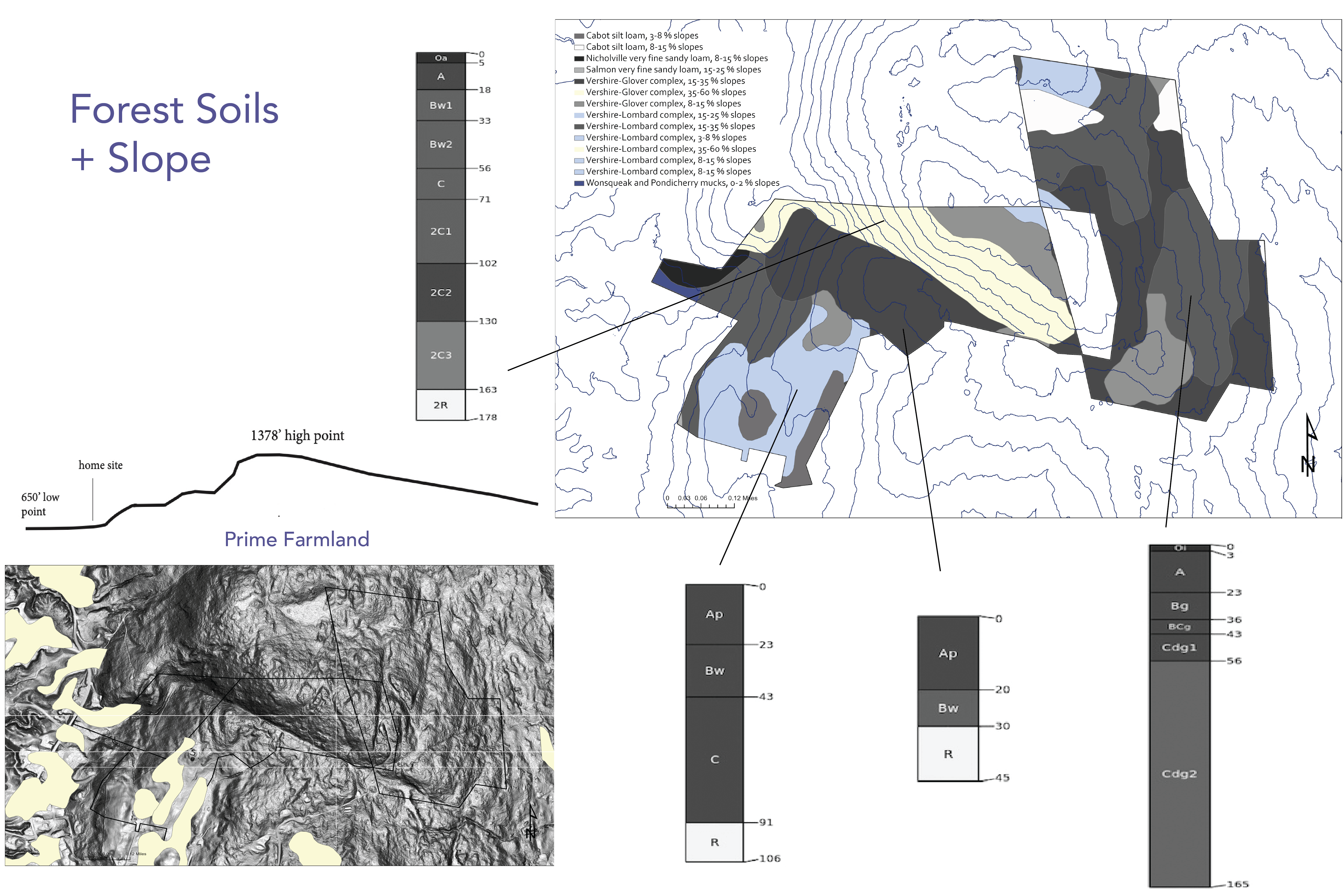
Conducting a thorough site analysis is an important first step to managing the natural resources on your property. Soil type, slope, water resources, and aspect are just a few of the initial assessments we conduct to help us understand your property. All design work and forest management plans originate with a thorough site evaluation.

Urban Forest Mapping
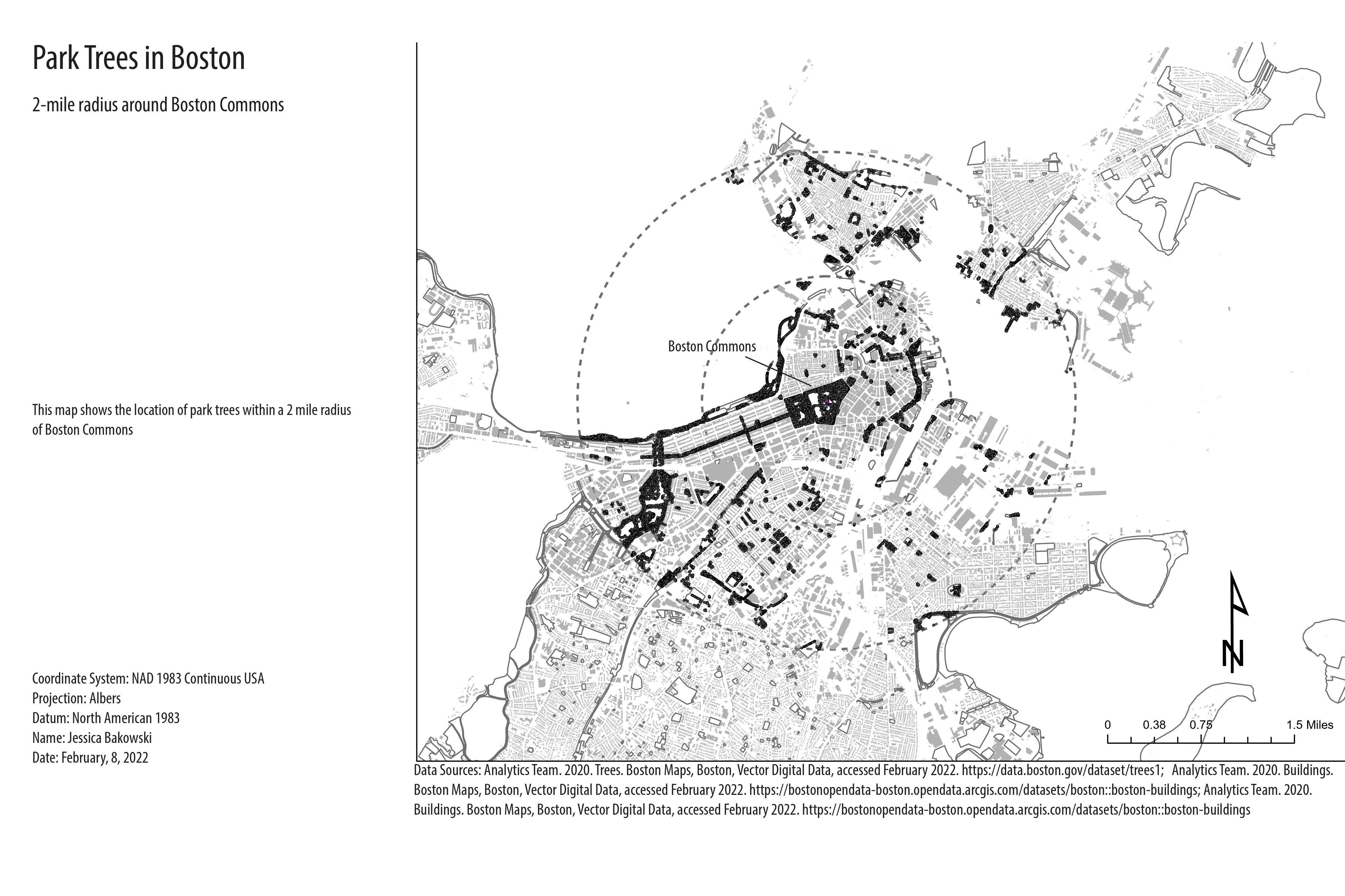
Creating a visual of where greenspace is located and where is it lacking can help municipalities and businesses with public spaces locate optimal tree planting locations. This map evaluates tree cover in greenspaces within a 2-mile radius of Boston Commons. Connective corridors and strategic tree planting can help create wildlife habitats, improve urban spaces, and promote healthy air quality.